


SPATIAL WEB APP | 2021 - 2024
For a number of years, Local and State Road Managers had been asking for a national mapping solution for the heavy vehicle industry. In response, the NHVR established the National Spatial Program and I was challenged with leading the user experience design of NHVR Maps. Liaising with key stakeholders at Local, State and Federal Government levels, I designed a spatial solution which gives Road Managers the ability to manage their roads and heavy vehicle networks in real-time. Supporting data was layered into the experience, including; live weather, predictive bushfire tracks, detours and CCTV feeds. All to create an intelligent national heavy vehicle self-service platform.
During the initial discovery phase, it became clear to me the immense scale of the challenge that lay ahead – Australia has the world's ninth-largest road network, with 750 Road Managers overseeing almost one million kilometers of roading infrastructure across six states and two territories.
With lock-down restrictions in place across a number of states, I ran a series of remote interviews and workshops with 27 Road Managers. From managers of small inner-city urban environments with mature roading infrastructure, to those overseeing expansive rural areas with thousands of kilometers of unpaved roads. Each with their own unique specific needs when it comes to managing road networks and routing heavy vehicles.
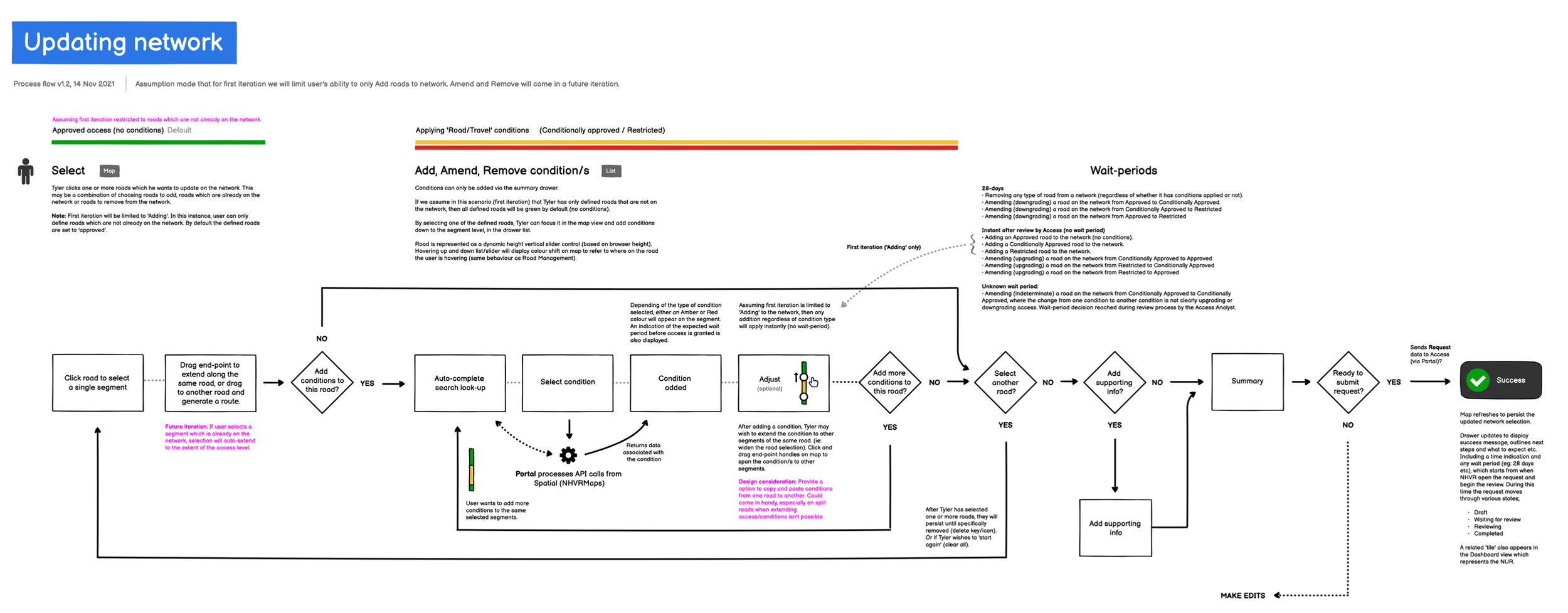
From these interviews I gathered feedback and insights. The key pain-point that I discovered, was the current method for updating road networks. Road Managers are required (by law) to inform the NHVR of network updates. Yet these are currently communicated via PDF forms which have to be completed manually and returned via email. A slow cumbersome process, involving many sets-of-hands, creating data inconsistencies and opportunities for human error.
I produced a series of detailed user journey maps to illustrate differences between current work-flows and proposed optimised journeys.
Working alongside geospatial engineers I further developed my knowledge and understanding of spatial technologies. I designed a creative solution to dynamically update map data in real-time. Empowering users with full self-service management over their roading infrastructure and heavy vehicle networks.
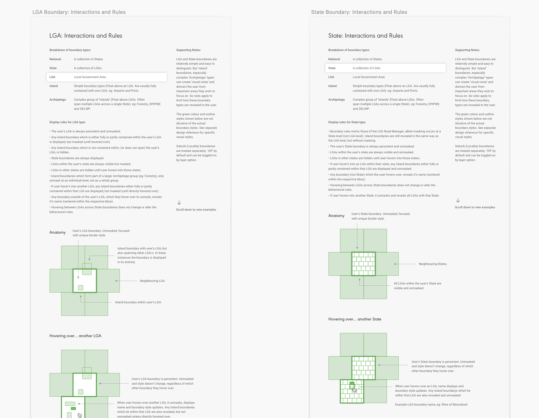
Each Road Manager has a specific boundary type to clearly define their area of responsibility. From those responsible for an airport with a relatively simple boundary, to State Forestry Road Managers who oversee several hundred separate parcels of land, each with their own heavy vehicle networks. I developed a consistent and scalable set of interactive rules to display these boundaries and reveal the heavy vehicle networks contained within.
Low-fidelity wireframes and clickable prototypes were developed to validate the design thinking with users, prior to development commencing.
At each stage of the design process, users were engaged with to help test and refine the design solution.
I designed a detailed set of UI components and worked closely with front-end developers to ensure accurate execution.
Working with MapBox I assisted the developers in styling open-source spatial data from OpenStreetMaps (OSM).